
Hop Earth map
How the Hop Earth Map Works: OpenStreetMap Roads and Satellite Elevation
Learn how the Hop Earth map works, including its use of OpenStreetMap roads, satellite elevation data, world exploration mechanics, and practical tips for understanding the drivable Earth.
How the Hop Earth Map Works: OpenStreetMap Roads and Satellite Elevation
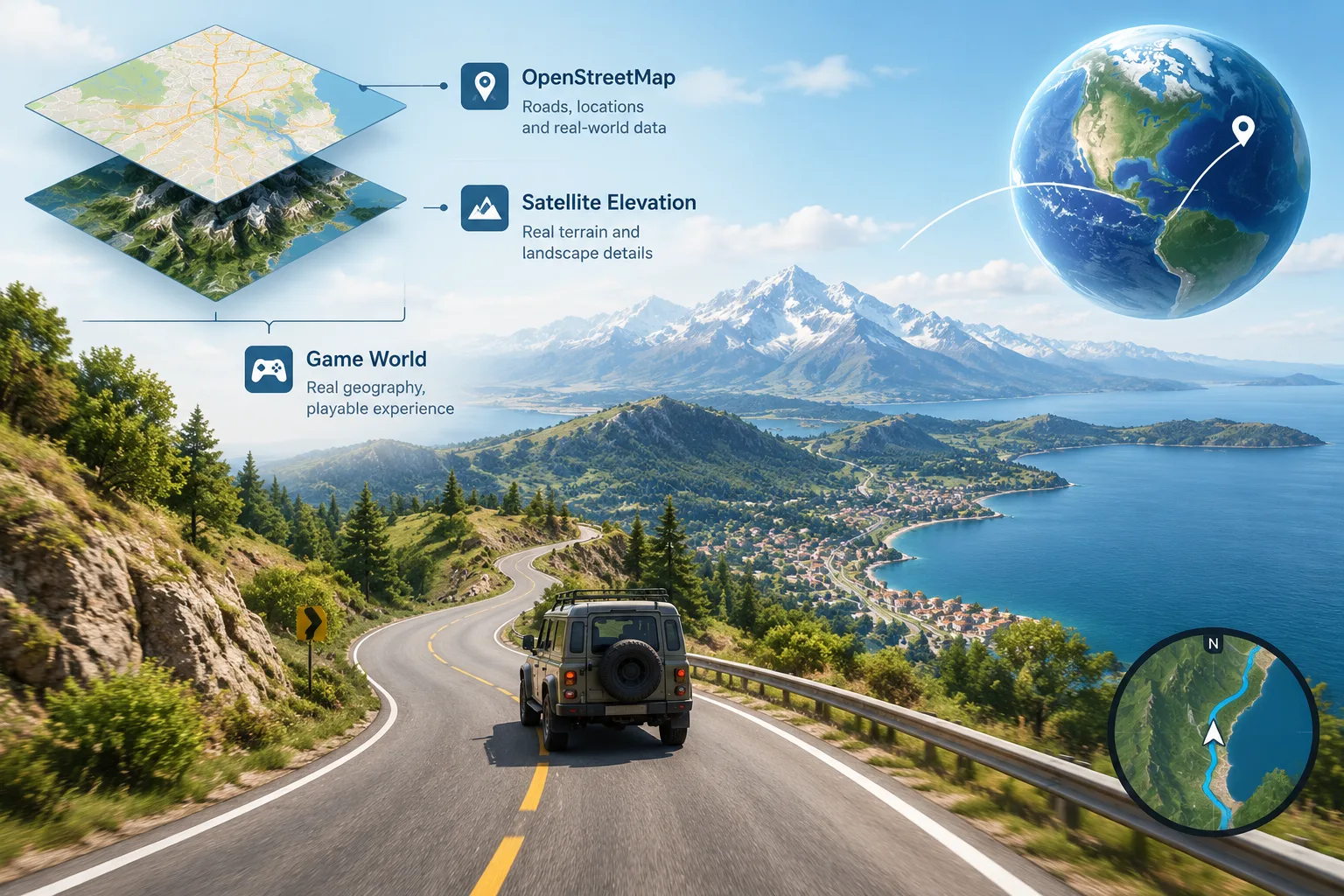
The Hop Earth map works by combining real-world geographic information with a game world designed around Earth exploration. Instead of using a completely fictional landscape, Hop Earth uses map-based data to represent roads, locations, and terrain, creating a driving experience connected to the real planet. The game relies on technologies such as OpenStreetMap-style road information and satellite-based elevation data to build a world players can explore.
For players asking “how does Hop Earth work?”, the simple answer is that the game converts real geographic information into a playable environment. Roads and terrain features come from mapping data, while the gameplay layer adds vehicles, movement, exploration, and multiplayer experiences. This approach allows players to discover places that feel connected to actual geography rather than a traditional handcrafted game map.
What is the Hop Earth map?
The Hop Earth map is a digital representation of Earth that allows players to travel through locations based on real-world geography. Instead of navigating a small fixed level, players interact with a large-scale environment built from geographic information.
The concept combines several elements:
| Map element | Purpose in the game experience |
|---|---|
| Roads | Provide routes for driving and exploration |
| Terrain data | Helps represent hills, mountains, and elevation changes |
| Geographic locations | Connect gameplay with real places around the world |
| Game systems | Add vehicles, challenges, and player interaction |
A real-world map foundation creates a different style of exploration compared with conventional open-world games. Players are not only memorizing developer-created areas; they are learning how geography influences movement and routes.
For more general information about the game experience, see the wiki section covering Hop Earth basics.
How does Hop Earth use OpenStreetMap data?
Hop Earth OpenStreetMap integration means the game can use community-created geographic information about roads and locations. OpenStreetMap is a worldwide mapping project where contributors create and maintain geographic data that can be used by applications, websites, and other digital services.
In a map-based game, road information is especially important because roads define where vehicles can travel. A road network provides the structure needed for exploration, route planning, and realistic movement across different areas.
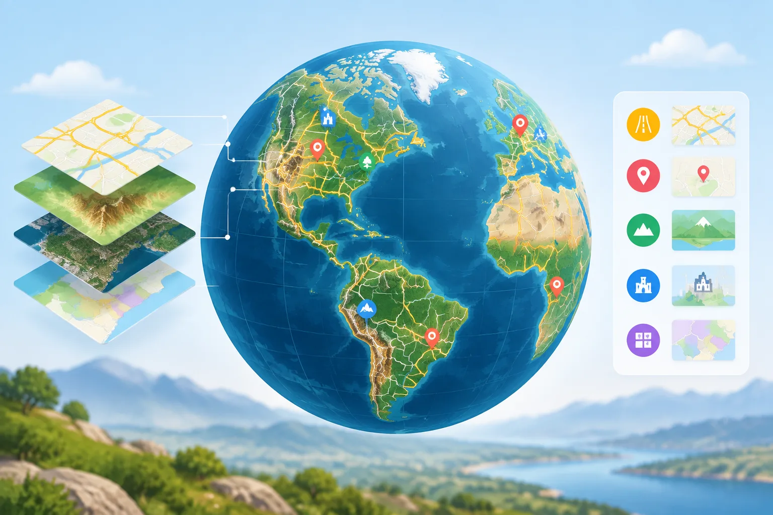
OpenStreetMap data can include details such as:
- Road locations and connections
- Place names
- Geographic features
- Points of interest
- Different types of mapped areas
The exact way any game processes external map data depends on its own technical implementation. A map-based game may simplify, transform, or combine data sources to create a smoother player experience.
Why are real roads important in Hop Earth?
Real roads give the Hop Earth world a sense of familiarity. A player can recognize that a route follows the shape of an actual location rather than an entirely invented track.
This creates several gameplay benefits:
Exploration feels meaningful
Driving through a landscape connected to real geography can make exploration more engaging. A mountain road, coastal route, or city street can feel different because the environment is influenced by the characteristics of real places.
Routes become naturally varied
Real-world roads are not designed like racing circuits. They include curves, intersections, highways, narrow paths, and changes in elevation. This variety can create unexpected driving situations.
Players can learn geography while playing
A map-based game can encourage curiosity. Players may discover regions they have never visited, compare landscapes, or understand how terrain affects transportation.
How does satellite elevation affect the Hop Earth map?
Satellite elevation data helps represent the height differences of Earth's surface. Elevation information describes how high or low terrain is compared with a reference level, allowing digital environments to include mountains, valleys, and slopes.
For Hop Earth, elevation data is important because a flat map would not accurately represent many real locations. Terrain changes can influence how a route feels and how players experience different areas.
Examples of elevation effects include:
- Mountain roads becoming steep and challenging
- Valleys creating different travel paths
- Coastal areas having flatter terrain
- Hills affecting the visual appearance of routes
Satellite-based elevation datasets, such as those created through missions like NASA's Shuttle Radar Topography Mission, have helped improve digital terrain modeling around the world.
How does Hop Earth turn map data into gameplay?
The map is only the foundation. A playable game requires additional systems that convert geographic information into an interactive experience.
The process can be understood in several stages:
1. Geographic data collection
Mapping information provides the basic structure of the world. Roads, terrain, and locations form the underlying geographic framework.
2. Data processing
Raw geographic information must be prepared for use in a game environment. This can include organizing data, reducing complexity, and adapting information for performance.
3. Gameplay integration
The game adds vehicles, controls, challenges, and player systems on top of the geographic foundation.
4. Real-time presentation
When players explore, the game loads and displays the relevant environment based on their location and actions.
This approach is different from traditional games where every road and landscape feature is manually created by designers.
How do players explore the Hop Earth map?
Players generally interact with the map through movement, discovery, and driving. The exact mechanics can change as the game develops, so players should separate confirmed features from community observations.
Verified concepts include:
- The game uses a real-world map approach.
- Geographic data is central to the experience.
- Players explore locations through vehicle-based gameplay.
Community strategies may include:
- Choosing routes with interesting terrain
- Exploring unusual geographic areas
- Practicing driving techniques on different road types
For more player-focused advice, visit the Hop Earth driving section.
What are some practical Hop Earth map tips?
Understanding the map can help players make better decisions while exploring.
Check terrain before choosing a route
A route that looks short on a map may not always be the easiest. Mountain areas, winding roads, or complex intersections can change the experience.
Use geography as a guide
Large geographic features can help players understand where they are. Coastlines, mountain ranges, and major cities provide useful reference points.
Expect differences between map data and game behavior
Real-world geographic data does not automatically create a perfect simulation. Games often adjust information for performance, accessibility, and gameplay balance.
Explore different regions
One advantage of a global map system is variety. Players can compare urban environments, rural roads, and natural landscapes without staying in one location.
How does Hop Earth multiplayer use the map?
Hop Earth multiplayer uses the shared world concept to allow players to interact within the same geographic environment. A real-world map creates opportunities for races, exploration, and location-based challenges.
Multiplayer experiences may depend on current game features and updates. Players interested in competitive modes can learn more through the Hop Earth multiplayer guide.
Frequently asked questions about the Hop Earth map
Does Hop Earth use real-world maps?
Yes. Hop Earth is designed around a real-world map concept that uses geographic information to create an Earth-based exploration experience. The game combines mapping data with gameplay systems rather than relying only on fictional locations.
What is OpenStreetMap used for in Hop Earth?
OpenStreetMap provides a community-built geographic database that can include road networks and location information. In map-based applications, this type of data helps create realistic geographic structures.
Does Hop Earth use satellite data?
Hop Earth uses satellite elevation concepts as part of its terrain approach. Elevation data helps digital environments represent differences between flat areas, hills, and mountainous regions.
Can players visit any place on Earth?
The goal of a real-world map game is broad geographic exploration, but the exact playable coverage depends on the game's systems, available data, and technical limitations.
Is Hop Earth the same as a traditional open-world game?
No. Traditional open-world games usually use handcrafted maps created specifically for the game. Hop Earth is based on real geographic structures, creating a different type of exploration experience.
Does Hop Earth have redeem codes?
No. Hop Earth does not have a codes mechanism. Pages claiming to provide official redeem codes should be treated carefully.
Explore more Hop Earth guides
The Hop Earth map is the foundation of the game's exploration experience. Understanding how geographic data, roads, and elevation work can help players better appreciate the world they are driving through.
Continue exploring the wiki for guides about Hop Earth basics, driving tips, and games like Hop Earth.
For the official game experience, visit the official Hop Earth website at https://hop.earth and continue exploring the world built from real geography.